Storm Ciarán hits Sussex: How bad will the weather get today?
and live on Freeview channel 276
The Met Office has warned residents to expect delays or cancellations to train and bus services, possible flooding of homes and businesses and flooded roads.
The Met Office is also warning about potential dangers from high winds, which include: flying debris, damage to buildings and power cuts.
Advertisement
Hide AdAdvertisement
Hide AdA Met Office spokesperson said today: “Strong and potentially disruptive winds associated with Storm Ciarán are possible until late afternoon.”
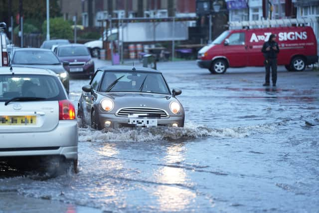

The Met Office said wind and rain could get heavier this afternoon with the worst period being between about 1pm and 4pm.
A forecast read: “Very unsettled Thursday with outbreaks of heavy rain and strong winds throughout. Severe gales possible along exposed coastal regions, with a risk of storm force winds for a time. Maximum temperature 12 °C.”
The forecast for tonight read: “Strong winds and pulses of heavy rain continuing into the evening, winds beginning to ease slightly through the small hours of Friday morning. Minimum temperature 7 °C.”
Advertisement
Hide AdAdvertisement
Hide AdFriday is expected to be ‘calmer and brighter’ compared to Thursday, ‘although still feeling breezy’ with isolated showers possible during the day.
The Met Office said ‘some good clear periods’ will develop overnight, with highs of 13 °C.
The weather is expected to become ‘unsettled again’ on Saturday with ‘outbreaks of heavy rain and breezy conditions’ developing through the morning. It will be brighter on Sunday and Monday but ‘remaining breezy with showers, mostly towards the coast’.